Geomatics News

We have provided this Geomatics News section to allow our members and corporate sponsors the ability to share any geomatics related news or information with the geospatial community.  This page works much like a typical blog, so others can add comments to any news post, or include the information on their own website using the RSS feed

To expand the content, simply click on the article title, click the blue arrow located after the title or click the Read more link.

To add geomatics related content simply click the 'add post' button below and enter your details in the appropriate boxes that appear. [Note: you must be logged-in to your GANS member account to post information below, so if you do not see a button then you may not be logged-in].


  • 28 Apr 2016 10:21 PM | Anonymous

    The Copernicus Masters competition 2016 is now open for submissions - with new challenges, renowned partners and an immense prize pool.

    Since 2011, the Copernicus Masters competition has evolved into the leading innovation platform for promoting user uptake of Earth observation data in a commercial and societal context. It showcases new ideas and trends each year in serving as an integral part of an international innovation network. Over the past five years, Copernicus Masters has already selected a total of 39 winners from among more than 1,200 entrants from 60 different countries, who have submitted over 700 cutting-edge business ideas.

    With support from its international network, the Copernicus Masters also aids participants in realising their applications and business models. This year's edition will once again feature challenges and corresponding prizes to be awarded by a series of prominent partners, including the European Space Agency (ESA), the German Aerospace Center (DLR), T-Systems International GmbH, Satellite Applications Catapult Ltd., the German Federal Ministry of Transport and Digital Infrastructure, and Stevenson Astrosat Ltd. The University Challenge, meanwhile, will be geared specifically towards students and research employees. The prize pool includes cash awards, satellite data access and quota as well as support-packages and is worth EUR 300,000.

    SMEs, start-ups, entrepreneurs, students and everyone with a brilliant idea is welcome to join and submit their entries from 15 April to 18 July 2016 at www.copernicus-masters.eu

  • 07 Apr 2016 8:40 AM | Anonymous

    Today (April 7), I attended the Community Mapping Showcase at the Centre of Geographic Sciences (COGS). 

    Maps Tell the Stories We Choose to Tell

    This project is a collaboration between the Age Advantage Association (AAA), a not for profit group of senior (elders) in the Annapolis Valley and  the instructors and students in the Diploma of Geographic Sciences, Community  and Environmental Planning program. Key contacts are Heather Leblanc (AAA) and Ed Symons and Monica Lloyd (NSCC). The interactive web-based maps are delivered both through Esri ArcGIS Online and Google Maps. Check out the web site at www.mapannapolis.ca 

    Community Mapping - Maps Tell the Stories We Choose to Tell

    This inter-generational project allows seniors to bring their local knowledge of the landscape to the map, and COGS students to bring their GIS and cartographic expertise to the table.

    the Walter Morrison collection of historic

    Specific maps for the Annapolis Valley include:

    • historic homes/ cemeteries
    • wharves,churches,trails
    • black loyalist/ Acadian home sites
    • cultural assets
    • Bear River artisans
    • The most recent innovation is the creation of an online form which allows community members to propose and add additional features to the geographic database.

    As part of the showcase, Trish LeBlanc  from the  COGS Map Library provided a tour of the Walter Morrison collection of historic maps. This Collection was donated to NSCC COGS by Walter Morrison, Cartographer Emeritus of COGS who was interested in antique maps as an illustration of the evolution of map making technology. It is a mixed media print collection of over 2000 historical maps, atlases, periodicals and books that is focused on the early mapping of Atlantic Canada and specifically Nova Scotia.

    Here, cartography students can compare maps of the early settlements with their present representation. http://bit.ly/COGSmaps

    Where to go from here ?

    Currently, the community mapping project is hosted using the technology available at the college. It offers a rich and eclectic view of the cultural landscape. Much of it based on a series of maps commissioned by Annapolis Ventures ' Cemeteries, Graveyards and Burying Grounds in Annapolis County' n.d.. If these online community maps are to be used for Community Planning, then it will be important for the technology to remain current. To address these concerns, there will need to be agreements about ownership of the data, quality control and access for decision - making purposes. 

    The community mapping project is an excellent initiative which uses the skills and interests of the local residents , and links to the GIS at  the college. To be sustainable, it likely requires its own portal, with appropriate access rights for the different 'communities of interest'.

    Modern web GIS facilitates this type of collaboration, where local connects with global. The Annapolis Valley has a wonderful resource at COGS, which can help address deeper conversations about the creative rural economic (Greg Baeker) and place-based education (David Gruenewald and Gregory Smith).

    There are a number of similar initiatives happening in other parts of rural Canada. For example, Vancouver Island (www.whereishereculturalmapping.com).
    the Walter Morrison collection of historic

    In conclusion, in the words of Map Annapolis :

    '"Community- created asset maps are based on the premise that local residents possess expert knowledge of their local environment which can be expressed in a geographic framework which is easily understandable and universally recognized. Participatory maps often represent a socially or culturally distinct understanding of landscape and include information that is excluded from mainstream.

    References

    Greg Baeker. Rediscovering the Wealth of Places: a municipal cultural planning handbook for Canadian communities. Published by Municipal World.
    David A. Gruenewald and Gregory Smith (ed.) 2008. Place-based Education in the Global Age. Taylor and Francis.

    About the author

    Bob Maher is a Geographer, living in Paradise, Nova Scotia. In the 1980's he designed, developed and delivered a number of intensive computer programming programs at COGS. In 2000, he returned as Senior Research Scientist at the Applied Geomatics Research Group until his retirement in 2011. He has worked closely with the Geomatics industry for over thirty years.


  • 30 Mar 2016 9:08 AM | Anonymous

    GeoAlliance Canada was pleased to host over 70 professionals for its inaugural meeting, “Map to the Future”, held in Calgary March 15-16 2016. 
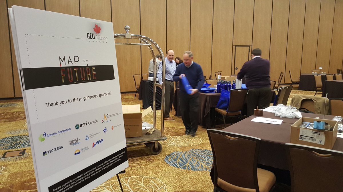
    GeoAlliance Canada’s “Map to the Future”

    Attendees represented a cross-section of the geography, geomatics and geospatial community across industry, education, government and non-profit organizations. They worked collaboratively to validate the GeoAlliance mandate, brainstorm opportunities, risks, and actions, and suggest specific projects that would benefit the entire geo community.

    The laudable efforts of the Interim Board of Directors of GeoAlliance Canada to bring the proposals developed by the Canadian Geomatics Community Round Table (CGCRT) to fruition were strongly supported by the community through attendance at this event and offers of financial support to make it possible. 

    GeoAlliance Canada’s “Map to the Future”

    Attendees were welcomed to Calgary by Brad Ashley, Chair of GeoAlliance Canada’s Interim Board, who gave some context about the purpose of the event and the importance of capitalizing on this opportunity to begin development of meaningful, impactful projects to raise the profile of the geomatics sector. Brad spoke at length on the challenges this new organization has faced, from workload to cash flow, to the need to work collaboratively as a sector to ensure future growth. 

    Our Keynote for the event was Dr. Alex Bruton, the Innographer, who spoke on the difficult and uncomfortable process of innovation, comparing it to learning how to ride a unicycle or “backwards bike”. He stressed that not every idea for creating a better industry will be a good one, meaning one that is both feasible and will have a high impact. He showed that for every 3000 ideas, generally only one will succeed. Dr. Bruton asked the attendees to think outside the box and come up with viable strategies for innovation within our industry and not be deterred by challenges or setbacks.
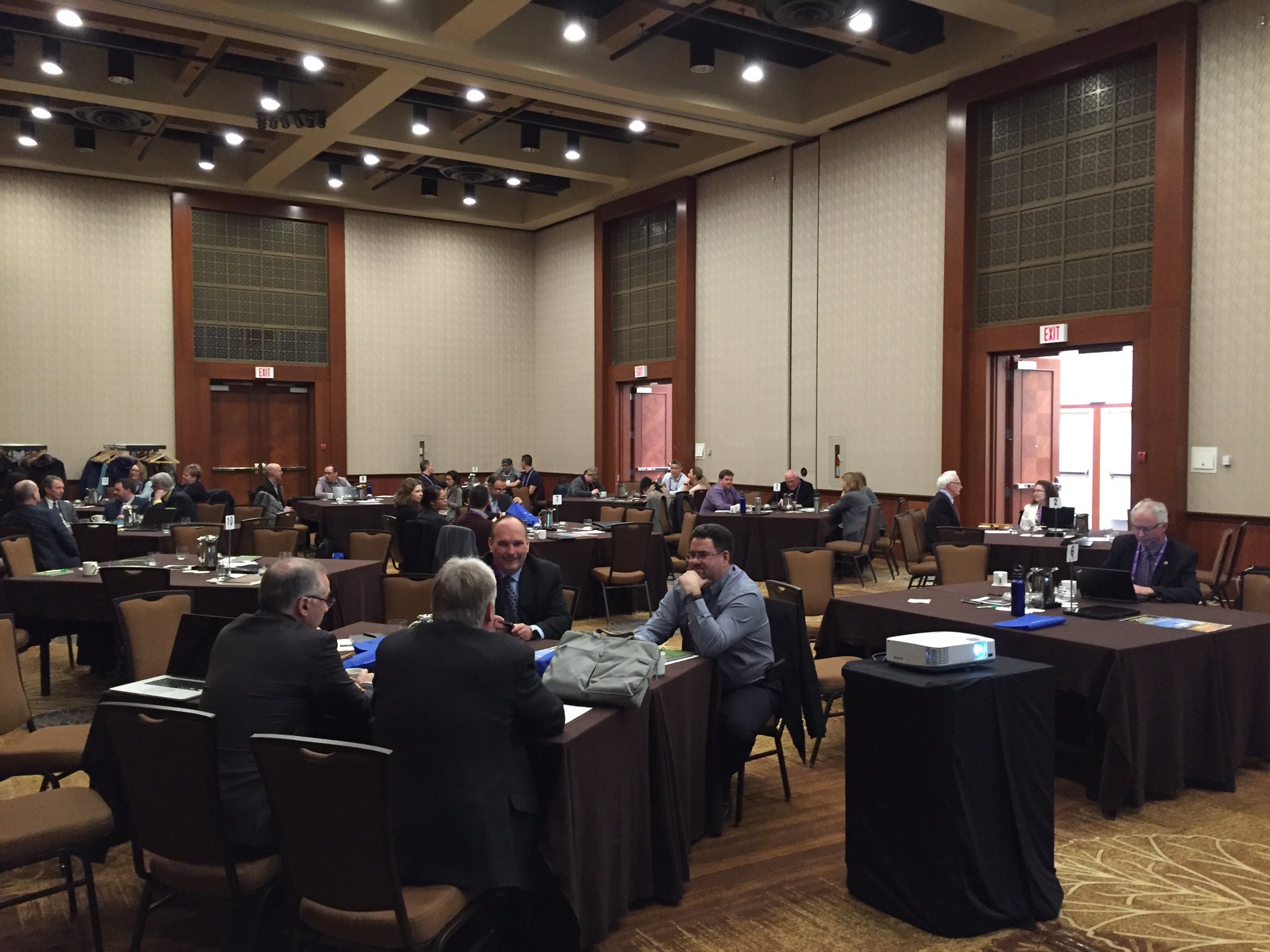
    GeoAlliance Canada’s “Map to the Future”

    The majority of the time over two days was dedicated to working individually or in small groups on worksheets provided by the event facilitators, Design Cofounders. The facilitators walked attendees through the process of first validating GeoAlliance Canada’s mandate by giving thoughtful input about the opportunities and risks it creates for individual organizations and the sector, and then brainstorming actions for the ways we can all take advantage of the opportunities while mitigating the risks. 

    Attendees were given the opportunity to collaborate with other members across all sector segments (education, non-profit, government and industry) to develop potential projects for the community to undertake to address common goals and challenges. It was stressed that GeoAlliance Canada should be seen as a solution facilitator rather than a solution provider, and that their mandate is to help create conditions that support the success of projects undertaken by the geo community.

    To this end, the project concepts were self- and peer-evaluated for their desirability (are they for the good of the community?), feasibility (likelihood of getting off the ground) and viability (likelihood of long-term success or sustainability). 
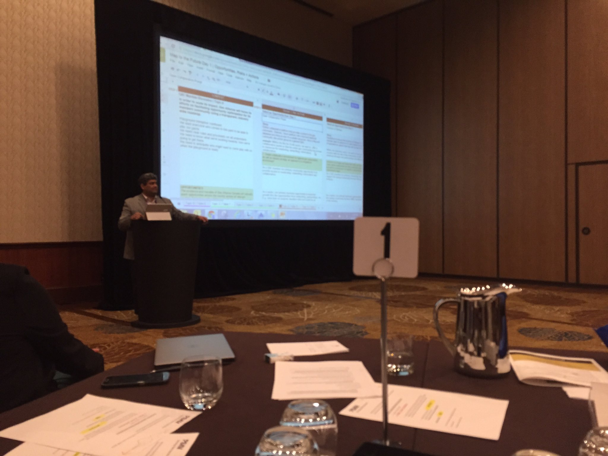
    GeoAlliance Canada’s “Map to the Future”

    Several project concepts were presented to the room for feedback, and all project concept and evaluation cards were then collected for review by the GeoAlliance Canada Board. Additional project ideas will be collected through the GeoAlliance website in the coming months – it was reiterated frequently over the course of the event that this initial collection of projects is just the beginning, and certainly will not be the only chance to put forward a project for consideration. Further details about the work undertaken at Map to the Future are available here.

    The GeoAlliance Canada Board will take the outcomes, suggestions and feedback from this meeting and form an external project review committee reporting to the Board of Directors. This will allow for a transparent project pipeline, and the committee will include both members of our community and those in peripheral fields. This committee will assess incoming project concepts and work with the submitters to ensure the idea is shovel-ready, build strong teams, find additional resources as required, and help shepherd an idea from the concept stage through to a successful conclusion. 

    As projects are funded and move forward, details will be provided on the GeoAlliance Canada website. Many thanks to everyone who sponsored, attended, or followed along on Twitter. Map to the Future was a first step for GeoAlliance Canada, and we hope we will look back on it as a leap forward for our community.

    While the work to define and implement meaningful community projects has begun, further investment by willing partners will be required to bring them to fruition. Those who participated in the Calgary meeting demonstrated an interest and willingness to make this fledging new organization a success, but GeoAlliance Canada will continue to grow and evolve. We look forward to working with our members and the Canadian geo community to build bridges, collaborate, and promote our work across Canada and on the world stage. 

    Ed Kennedy and Brad Ashley from http://geoalliance.ca


  • 14 Mar 2016 4:06 PM | Anonymous

    Online Digital Atlas: A Shared Vision

    Every year, a small team of Esri staff travels to COGS to recruit new talent. As part of the interview process, they provide a demonstration of the lattest ArcGIS functionality. Returning home from Haida Gwaii in February, I was interested to check out some of the new developments, especially since I had been far removed from the detailed GIS functionality for several years.

    This led to a re-connection with Clint Brown from Esri (Redlands), and a copy of Esri’s new book, ‘the ArcGIS Book. What struck me from the ArcGIS demonstration was that the new software tools seem to allow for closer collaboration between community groups, government agencies, educational institutions and industry. These tools include the ability to manage different layers, with different access rights, stored either on the server or in the cloud.

    Geography is Key for Integrating work across Communities ...

    While reading the ArcGIS Book, I noticed that the last of the ten 'Big Ideas' was that 'GIS is social. GIS is collaborative' and that 'Geography is key for integrating work across communities'Therefore, it seems that the time is right to test the 'collaborative' hypothesis.

     Coincidentally, the Nova Scotia Provincial Government was announcing their new open data policy and created a new online open data site providing the geospatial community with free access to base maps and data sets featuring Nova Scotia. And by chance the Geomatics Association of Nova Scotia (GANS) has been recently working on a concept for an online digital atlas (Digital Atlas of Nova Scotia - DANS).

    An online digital atlas would allow the geospatial community to have the tools to develop web and mobile apps that accesses a combination of their own databases combined with maps and spatial data from other agencies and organizations (such as open data portals). Each data layer (or map) from the digital online atlas would have various terms and conditions for sharing information.  Some layers would be read only while other layers would be able to be updated by the geospatial community under certain conditions.

    The significant role proposed by GANS to obtain the technology resources to support apps and associated maps will help them remain sustainable into the future and remain a leader in the geomatics sector. However, this is only one pillar of the shared vision.

    What is the next step in the process, as we move forward?

    Community groups must have the resources to develop their applications. We need the next generation of application developers. Through training, mentoring and curriculum changes in our educational institutions, we can address this shortcoming.

    On Haida Gwaii, John Broadhead at the Gowgaia Institute has talked about the need for an online atlas of the natural and cultural resources. 

    GANS is promoting a similar concept here in Nova Scotia. At the community level, groups appreciate the need for application development to meet the needs of citizens, visitors, as well as the municipal government. This follows five years after the work by Paul Beach in Sault Ste Marie. He championed the concept of a 'community information utility', today, the tools are readily available, in a more collaborative world.

    We can imagine a nested set of geographies. The Annapolis Valley lies within the region of Southwest Nova, within the province of Nova Scotia. Each region recognizes its geographic context. The same approach can be applied to Cape Breton, the South shore. Indeed, it could be part of the standard infrastructure for existing Regional Enterprise Network (REN) and could be linked to existing products e.g. i-valley.ca

    What are the steps to turn this 'Idea'  into 'Action' ?

    1. determine the extent of the geography
    2. obtain digital base maps at the appropriate scale
    3. decide on the community mapping need:
              - historic properties
              - trails
              - land use
              - tourism facilities
    4. design the 'look and feel' of the user interface
    5. determine whether web/mobile app. or both
    6. hire application developer
    7. prototype application
    8. testing
    9. marketing and sales
    10. product release

    Why now?

    The technology has matured so that a properly monitored portal can serve up the different data sets, and yet meet the security needs of the data providers. There is recognition that to successfully apply these technologies we need more collaboration.

    The need to visualize the geography of rural Nova Scotia is important to economic development. The skills and products developed through this process are transferable to other geographies, applications and markets

    Access to a digital atlas is a prerequisite for groups to develop apps. that meet the local needs of citizens. Whether the underlying technology is Esri, Google, Open Source or a combination, we are seeing a shared vision of digital geography.

    References

    About the author

    Bob Maher is a Geographer, living in Paradise, Nova Scotia. In the 1980's he designed, developed and delivered a number of intensive computer programming programs at COGS. In 2000, he returned as Senior Research Scientist at the Applied Geomatics Research Group until his retirement in 2011. He has worked closely with the Geomatics industry for over thirty years.


  • 10 Feb 2016 10:32 AM | Anonymous

    It is a pleasure to bring you an update on the activities of GANS, the Geomatics Association of Nova Scotia, as we reach the half-way mark of our 2015-2016 year.

    Your Board of Directors and Working Groups have made considerable progress on the goals presented at the 2015 Annual General Meeting. 

    We would like to highlight a few of the many accomplishments (http://gans.ca/2016-Presidents-Letter)


  • 27 Jan 2016 8:12 AM | Anonymous

    Geography Helped Me Get Where I am Now - GANS Geographic Education Posters Series 

    The GANS Geographic Education Posters were created to help young people identify some of the endless possibilities that learning geography provides, by highlighting the various different geomatics related post-secondary education programs and geospatial related career opportunities available, ultimately resulting in more students pursuing geomatics related careers.

    All the professionals featured are graduates of Nova Scotia high schools and have followed a variety of post-secondary paths, including both colleges and universities, to get where they are today. - Geography Matters! 

    The Geographic Education and Geospatial Related Careers page includes links to digital versions from the first round of GANS Education Posters. Clicking on an image below will open up a dedicated web page highlighting the individual with a larger digital PDF version of the custom poster and a short summary of the person’s post-secondary path, present job title and their story on how Geography Helped them Get Where they are Now .

    We encourage you to check them all out and share with your friends, colleagues, co-workers and extended networks. We will also be adding more images and narratives about other young Nova Scotian geospatial professionals in the future, so also hope that you will come back to the Geographic Education and Geospatial Related Careers page again. http://gans.ca/Geospatial-Careers


  • 16 Dec 2015 1:27 PM | Anonymous

    Canada’s geospatial community received a significant boost today with the signing of a 1.5 year funding contribution agreement with Natural Resources Canada. GeoAlliance Canada, a national non-profit umbrella organization, received this funding in support of their mandate to provide essential leadership within the geomatics, geography and geospatial sector. 

    GeoAlliance Canada was launched in April 2015 by the consensus of community leaders who recognized the potential for a national organization to fuse together the energy and resources being expended by a highly fractured sector. By coming together under one umbrella, diverse groups within the geospatial community are able to network and collaborate on projects of mutual interest. Through the engagement of key groups and organizations, GeoAlliance Canada has begun to articulate and promote the benefits of using geospatial data and tools for effective decision making to leaders within business, government and education circles. The contribution funding from Natural Resources Canada will have an immediate impact by providing essential operational resources for this fledgling non-profit organization.

    GeoAlliance Canada’s Board of Directors has released the following statement:

    We wish to thank Natural Resources Canada for their ongoing support for initiatives promoting the use of geospatial data, tools and technologies in Canada, including the Canadian Geomatics Community Round Table and now GeoAlliance Canada. The funds released under this contribution agreement will support GeoAlliance Canada over the next year and a half as we work to engage the geomatics, geography and geospatial communities. We will draw from this significant resource to increase Canadians’ understanding of the role of “geo” in our economy and day to day lives. We look forward to working with our member organizations from the business, non-profit, education and government communities to drive forward projects that celebrate our long history of innovation in this sector and re-establish our leadership position on the world stage.

    For more information about GeoAlliance Canada or this contribution funding agreement, please see http://geoalliance.ca/


  • 23 Oct 2015 2:58 PM | Anonymous

    GANS would like to announce that we have started a Creative Art/Map Competition for Nova Scotian Students

    The contest is open to students in all grades from primary to grade 12 as well as post secondary students. It is meant to help engage students in artistic cartographic activities while encouraging them to learn more about the geography, heritage and history of Nova Scotia. And at the same time promote Nova Scotia to the world and have some fun while doing it!

    Prizes will be awarded to 1st, 2nd, & 3rd place entries in 7 different categories

    Click here for more details about Creative Art/Map Competition for Nova Scotian Students


  • 21 Sep 2015 8:13 PM | Anonymous

    Did you know that Geomatics Atlantic 2015 is part of the 9th Symposium of the International Society for Digital Earth?


    Towards a One-World Vision for the Blue Planet


    Date: October 5-9, 2015
    Location: Downtown Halifax, Nova Scotia at the World Trade & Convention Centre


    Geomatics Atlantic is an annual regional conference that has been hosted by GANS & CIG Atlantic Chapters for the past 25 years. The event originally started out in the 1990s as workshops that addressed gaps in communications between the geospatial community of various different departments and geographies. Those workshops focused on what the future of the geomatics sector would look like and how we would get there.

    The workshops latter expanded into larger conferences with outside guests from industry and academia being invited, raising the level of discussions. Geomatics Atlantic then started to include exhibit halls for vendors and moved from city to city, rotating around the Atlantic region instead of being hosted in the same place every year. Each participating organization would take their turn hosting the annual event as it rotates through the Atlantic provinces.

    This year it was GANS turn to host Geomatics Atlantic here in Nova Scotia, and traditionally it would have been held during late spring. However a rare opportunity to co-host an International Gala Event came up so GANS has partnered with the 9th Symposium of the International Society for Digital Earth and Geomatics Atlantic will be held in October.

    In 2 weeks from now scientists, engineers, technologists, managers and the geospatial community  from around the world will come together in Halifax to share concepts, research findings, technologies, and practical applications.

    We all know that Canada is in the forefront of research and development in the fields of geomatics, geospatial research, and environmental monitoring and Nova Scotia has a large cluster of agencies and institutions related to geomatics, digital technologies, and the environment, with regional and specialist agencies of many government departments, and world-class research at local universities and colleges.


    A preliminary program summary for the Digital Earth / Geomatics Atlantic 2015 is available with suggested Atlantic Canada sessions highlighted.

    There will also be a Ceilidh hosted on October 8 to celebrate the International Year of Mapping and will feature fine Nova Scotia food, drink and entertainment, as well as very special guests who will share their stories and vision for the Blue Planet.

    Registration fee for GANS members is $450 for the 5 day event, see http://digitalearth2015.ca/registration/ for more details & to register.

    Hope to see you all here in 2 weeks ...


  • 02 Sep 2015 4:26 PM | Anonymous

    Save-the-Date for the Land Registry Forum!

    Date: November 18th

    Location: Nova Scotia Association of Realtors, Dartmouth

    The Association of Nova Scotia Land Surveyors (ANSLS) and the Geomatics Association of Nova Scotia (GANS) are pleased to announce that they will present a one-day Land Registry Forum on Wednesday, November 18th. This open forum will be of interest to land surveyors and other geomatics professionals, as well as the community planning and development sector, financial services sector, the legal profession, the real estate sector and others.

    The registration fee is $150 for the full day event and includes lunch and refreshments.

    An exciting line-up of speakers and panel participants, from Nova Scotia and beyond, will be featured.

    Additional information and registration will be posted on the ANSLS http://www.ansls.ca/ and GANS http://www.gans.ca/ websites by the end of September. Save the date NOW!

    For further information, please contact ANSLS [email protected] or GANS [email protected] 

Check out the Geomatics Association of Nova Scotia Sponsors map


© Geomatics Association of Nova Scotia (GANS) - PO Box 961, Halifax, NS, B3J 2V9

Help us promote Geomatics in Nova Scotia by joining us in the following social media groups:

Follow The Geomatics Association of Nova Scotia (GANS) on Twitter Join The Geomatics Association of Nova Scotia (GANS) on Google+ Join The Geomatics Association of Nova Scotia (GANS) on FaceBook Join the The Geomatics Association of Nova Scotia (GANS) LinkedIn group add GANS news to your website via our RSS feed

Website design and management of Geomatics Association of Nova Scotia courtesy of tmackinnon

Powered by Wild Apricot Membership Software