Geomatics News

We have provided this Geomatics News section to allow our members and corporate sponsors the ability to share any geomatics related news or information with the geospatial community.  This page works much like a typical blog, so others can add comments to any news post, or include the information on their own website using the RSS feed

To expand the content, simply click on the article title, click the blue arrow located after the title or click the Read more link.

To add geomatics related content simply click the 'add post' button below and enter your details in the appropriate boxes that appear. [Note: you must be logged-in to your GANS member account to post information below, so if you do not see a button then you may not be logged-in].


  • 16 Jan 2019 2:47 PM | Anonymous

    On behalf of the GANS Board of Directors, we would like to announce that Candace MacDonald from the NSCC Applied Geomatics Research Group has stepped up to fill the recently vacant position of 2018-19 GANS President.

    Candace has been part of AGRG's Coastal Research Team since graduating from COGS in 2010 with an Advanced Diploma in Remote Sensing. She is an expert in complex raster and spatial GIS analysis, and uses the remotely acquired data she and other members of the Coastal Research Team collect using a wide range of high-tech equipment such as a shallow water bathymetric lidar system, a 3D mobile mapping lidar unit, a multibeam echosounder, and several drones for multispectral aerial photography. 

    Candace was one of the first young professionals represented in the GAN 'Geography Helped Me Get Where I am Now' Poster series. Click here to find out how Geography helped Candace get where she is today ...


  • 08 Jan 2019 7:21 PM | Anonymous

    Digital Nova Scotia is the industry association for Nova Scotia’s $2.5 billion digital technologies sector and the Geomatics Association of Nova Scotia now joins a growing number of digital businesses and stakeholders working together to foster Nova Scotia’s digital economy and increase global connections for global competitiveness.

    Digital Nova Scotia

    DNS programs, events, and opportunities will enable us to extend our digital community through skills development, capacity building, industry events, strong partnerships and the promotion of IT opportunities, as it continues to grow, evolve and thrive.

    Digital Nova Scotia helps connect industry with talent through an opportunities portal, connecting industry leaders through networking events and round table discussions, and connecting with national organizations to increase the profile of our sector and province. 

    Like GANS, Digital Nova Scotia is a membership driven organization with members ranging from startups and SME’s to large multinational corporations, universities and colleges, government, and non-profits. 

    The Best part is that GANS memberships provide members more benefits as Digital Nova Scotia membership benefits will be extended to all active GANS members.

    If you are not a GANS member, or not sure what your membership status is? 

    Then contact us and we can help you become a GANS member so that you too can take advantage of all the DNS benefits.


    All members of the Geomatics Association of Nova Scotia are welcome to enjoy the benefits of Digital Nova Scotia. Benefits include: 

    If you have any questions about DNS / GANS partnership or interested in receiving DNS email blasts for upcoming events, then contact us.

    In the meantime we encourage everyone to check out the Digital Nova Scotia website and to renew their GANS memberships


  • 10 Oct 2018 9:56 AM | Anonymous


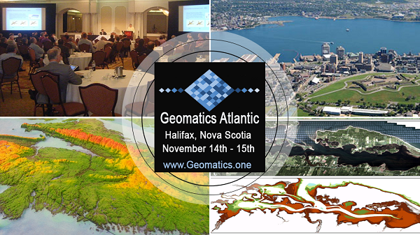
    LESS THAN FIVE WEEKS UNTIL GEOMATICS ATLANTIC CONFERENCE!

    Dear {Contact_First_Name},

    Below is a little information on the upcoming Geomatics Atlantic Conference including speakers, agenda, and more.

    Have you registered yet? There's still time! https://geomatics.one/registration


    Confirmed Speakers

    Below are a few of the 25+ speakers scheduled to present at this years Geomatics Atlantic. You can check out other speakers and their abstracts on the websites Speaker section (still being updated on the site as abstracts and speaker Bios come in)  https://geomatics.one/speakers


    Steve IrisManager and Senior Program Officer at Canadian Space Agency

    https://geomatics.one/speakers/xxx/steve-iris

    Since he joined the Canadian Space Agency in 2002, Mr. Iris  occupied various responsibilities. From RADARSAT-1 mission planner to manager of international relations responsible for Africa and South America, including support for the Space Affairs Advisor at the Canadian Embassy in Washington. 

    In December 2010 he became the Mission Manager for the RADARSAT Constellation, which ensures that the entire satellite system meets mission objectives and user requirements.

    The RADARSAT Constellation is the next step in evolution of the RADARSAT Program with the objective of ensuring data continuity, improved operational use of synthetic aperture radar (SAR) data and improved system in reliability.

    The mission consists of three identical C-band SAR satellites flying in a constellation which will provide complete coverage of Canada's land and oceans offering an average daily visit, as well as a potential daily access to 90% of any location on the globe.

    The main objective of the RADARSAT Constellation Mission is on meeting Government of Canada User Department's needs and requirements in Core Use Areas such as Maritime Surveillance, Disaster Management, Ecosystem Monitoring and Northern Development.

    The constellation is designed primarily as a wide area monitoring system, offering medium resolution data, but it will also offer high resolution imaging capabilities, including a Spotlight Mode, as well as multiple polarization including Compact Polarimetry.

    The greatly enhanced temporal revisit combined with accurate orbital control will enable advanced interferometric applications in between satellites on a four-day cycle that will allow the generation of very accurate coherent change maps. RADARSAT Constellation Mission frequent revisit capability, near real-time SAR data availability and vessel identification capabilities (through an AIS payload) will provide the capability to identify and monitor ships up before they enter national waters or ports.

    The RADARSAT Constellation Mission is currently under construction with satellite launches planned for 2018. This presentation will describe the overall RADARSAT Constellation Mission system, the space and ground segments, provide an overall project status and discuss activities surrounding Canadian Government user's operational readiness.


    Rachel O’NeilLead Geospatial Architect at Bluejack Consulting Inc.

    https://geomatics.one/speakers/xxx/rachel-oneil

    Rachel O’Neil has over 18 years experience working with Geographical Information Systems as a developer, consultant, application and system architect. This experience spans across major provincial, state and federal agencies across the US and Canada.

    Rachel’s master’s degree concentrated on machine learning and big data which has continued to grow and evolve into the field of GIS.

    This presentation will discuss the unique challenges associated with the nature and size of marine data, how the concept and practical implementation of the analysis of marine data can leverage big data concepts, future trends and directions. Discussion will also include existing implementations from vendor specific software to custom and hybrid applications and platforms.


    Jeremy Nicholson, Sales Manager  at CARIS Teledyne (Presenting on behalf of OGC Canada Forum)

    https://geomatics.one/speakers/xxx/jeremy-nicholson

    This presentation will introduce the Canada Forum which has been established is to better serve Canadian needs for geospatial data and services. The Forum is an informal organisation open to all Canadian Organisations  (including non-OGC members) and international OGC members conducting business or research in Canada. Example organisations include, but are not limited to Federal, Provincial, Territorial and Municipal governments, Indigenous Organisations, Academia, and Industry.  

    The Canada Forum will provide a platform for all stakeholders to increase collaboration with a focus on Canada's requirements for sharing geospatial data and information, capacity building, innovation, outreach, industry business development, and others. The forum is also intended to provide a venue for the community to improve the level of Canadian influence in the OGC geospatial standards process and related standards partners (e.g. ISO, IHO, GEO, UN-GGIM, W3C, CGSB).    

    The Canadian Forum intends to inform stakeholders on the objectives of the group in the East, West and North of Canada at a series of geomatics events. Another aspect of the Forum is to identify geospatial sectors where Canada excels so that this expertise can be highlighted globally. The Marine geospatial sector is one such sector so the presentation will also focus on the data standards work being conducted that relates to Ocean data.


    Renata DividinoSenior Data Manager at Global Spatial Technology Solutions

    https://geomatics.one/speakers/xxx/renata-dividino

    Dr. Renata Dividino has extensive expertise in knowledge management and artificial intelligence. She received her Ph.D. degree of Compute Sciences in Germany and has worked in diverse international research institutes (e.g. the German Research Center for Artificial Intelligence & the Institute for Web Science and Technologies).

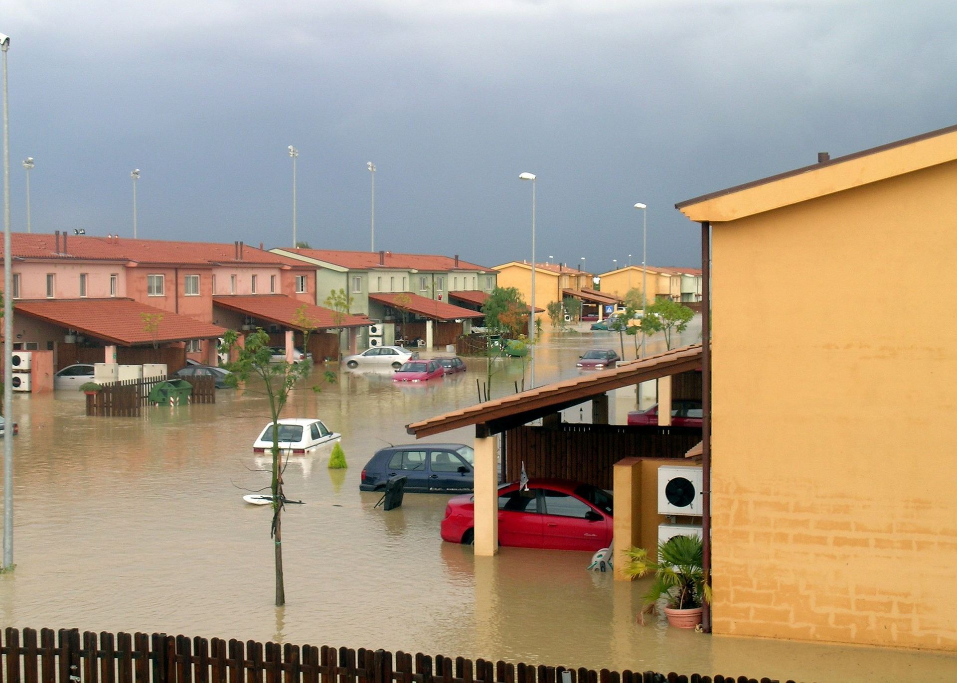
    She also spent several years in research for knowledge modelling and semantic integration of disparate information sources which has been successfully applied in many domains – from drug discovery in pharmaceutical companies to identifying suspicious activities at sea.

    Dr. Dividino recently left the Institute for Big Data Analytics at Dalhousie University where she researched how to better support the current and future information needs of naval decision makers aboard Royal Canadian Navy vessels to join a Halifax-based start-up - Global Spatial Technology Solutions. Dr. Renata Dividino leads the semantic Big Data integration to boost the machine learning model accuracy.

    The Interplay between Knowledge Graphs and Machine Learning

    Machine learning algorithms aim to make sense out of noisy data to generate data-driven insights. These algorithms, often called smart algorithms, are first given access to real-world examples of a huge data set, and then are set to detect patterns (or 'similar data') in other datasets in order to predict different events. As expected, the algorithms are only as good as the data behind them.

    High-quality data can be extracted from knowledge graphs such as from google’s knowledge graph and Wikidata. Knowledge graphs form crucial components of modern web search engines and state-of-the art question answering systems as they provide a semantic structure to the underlying  data, i.e., data becomes a source of information that machines can easily interpret, combine and reuse. In this talk, we will discuss how companies running machine learning applications can use knowledge graphs to fine tune results and increase processing capabilities.


    You can check out other speakers and their abstracts on the websites Speaker section (still being updated as abstracts and speaker Bios come in ... ) https://geomatics.one/speakers

    Venue & Accommodations 

    The newly renovated, Lord Nelson Hotel & Suites is pleased to welcome Geomatics Atlantic 2018 delegates to Halifax and are offering a block of Classic Guestrooms at a special group rate of $139.00 per day based on single or double occupancy, plus 2% Levy and 15% HST tax. Includes complimentary Internet and local/toll free calls.

    Booking with this code will also help subsidize the Geomatics Atlantic Conference

    Reservations at the group rate may be accessed through the following booking methods:

    Rooms at this rate are available until Friday October 12, 2018, subject to availability of Classic rooms. After this date, the rooms will be released from the block and back to the hotel for sale.

    If you have any questions or require further assistance, please contact our reservations department directly at 1-800-565-2020


    To find out more about the Geomatics Atlantic Conference go to Geomatics.one


    Special thanks to the Following Geomatics Atlantic Sponsors


    Platinum Sponsor

    Esri Canada Logo


    Gold Sponsor

    Bluejack Consulting Inc.

    Silver Sponsor


    Event & Media Sponsors:


        GoGeomatics Canada


  • 18 Sep 2018 11:41 AM | Anonymous

    2018 GoGeomatics Back to School Social in Halifax

    GoGeomatics Leadership Awards Presented to GANS Members

    Last week at the Halifax Back to School Social, Jonathan Murphy of GoGeoomatics presented Leadership Awards to GANS members, Jackie Edwards and Ted MacKinnon, for their continuous dedication and support to help ensure that the geospatial community thrives in Nova Scotia.

    GoGeomatics 2018 Leadership Award

    Jackie Edwards, GoGeomatics 2018 Leadership Award

    "GoGeomatics Back to School Socials and Monthly Meetups are what make GoGeomatics more than just a magazine, job board or event calendar. 

    Without our team of committed volunteers, these socials would be impossible. GoGeomatics could never have achieved the Canada-wide reach that we now have (with meetup groups in 15 cities) without the hard work of our group leaders. 

    This award recognizes group leaders who have shown outstanding dedication in organizing and promoting their groups throughout the year. 

    For their contribution to the growing Canadian geospatial community, I am happy to present the GoGeomatics 2018 Leadership Award to Jackie Edwards." Jonathan Murphy, GoGeomatics

    GoGeomatics 2018 Sector Leadership Award

    Ted MacKinnon, GoGeomatics 2018 Sector Leadership Award "This award honors a volunteer who not only organizes, promotes, and successfully leads their group throughout the year, but also acts as a mentor and influencer within the Canadian Geomatics Sector. 

    This individual has contributed more time and resources to the success of GoGeomatics than any other volunteer, and they are an example of an dynamic professional who is helping the Canadian geospatial community reach its fullest potential. 

    Therefore, I am proud to present the GoGeomatics 2018 Sector Leadership Award to Ted MacKinnon who has made a positive mark on the geospatial community from coast to coast" Jonathan Murphy, GoGeomatics


    To find out more about Halifax GoGeomatics Canada Monthly Networking Socials go to https://www.meetup.com/Halifax-GoGeomatics-Canada-Monthly-Networking-Social/


    2018 GoGeomatics Back to School Social in Halifax

    [Photo Sources: Dave MacLean & Jonathan Murphy]


  • 16 Sep 2018 7:14 PM | Anonymous

    The newly renovated, Lord Nelson Hotel & Suites is pleased to welcome Geomatics Atlantic 2018 delegates to Halifax!

    Lord Nelson AccommodationsWith pride in tradition dating back to 1928, the hotel is a beloved landmark in downtown Halifax dating back to 1928. Overlooking the beautiful Victorian Public Gardens, the Lord Nelson is located on the corner of Spring Garden Road, a popular location filled with restaurants, shopping and entertainment options.

    We are pleased to offer a block of Classic Guestrooms at a special group rate of $139.00 per day based on single or double occupancy, plus 2% Levy and 15% HST tax. Includes complimentary Internet and local/toll free calls.

    Booking with this code will also help subsidize the Geomatics Atlantic Conference

    Reservations at the group rate may be accessed through the following booking methods:

    Lord Nelson AccommodationsRooms at this rate are available until Friday October 12, 2018, subject to availability of Classic rooms. After this date, the rooms will be released from the block and back to the hotel for sale.

    If you have any questions or require further assistance, please contact our reservations department directly at 1-800-565-2020, (902) 423-5130, or by email at [email protected]


    https://geomatics.one/lord-nelson-accommodations-conference-rate.html


  • 07 Aug 2018 3:49 PM | Anonymous

    We are partnering with the Licensed Professional Planner Association of Nova Scotia (LPPANS) for a Pre-Note/Keynote with world renowned atmospheric scientist Katharine Hayhoe to speak about cross-sectoral approaches to dealing with climate change.Katharine Hayhoe Director of the Climate Science Center at Texas Tech

    It will be November 2nd at 10 am in the Dalhousie School of Architecture and Planning Auditorium (next to the Halifax Central Library). WHERE: November 2nd at 10 am @ Dalhousie School

    Katharine Hayhoe is the Director of the Climate Science Center at Texas Tech. Her research focuses on high-resolution climate projections to evaluate the future impacts of climate change on human society and the natural environment. She has published over 125 peer-reviewed articles and served as lead author on key reports for the U.S. Global Change Research Program and the National Academy of Sciences.

    https://geomatics.one/prenote-katharine-hayhoe.html


  • 30 Jul 2018 9:26 AM | Anonymous
    Summer is in full swing. Hopefully you have taken advantage of it and managed to enjoy lots of field work and vacation time during this nice weather!

    Since the AGM on May 25th at the Halifax Central Library, the GANS Board has been busy working together behind the scenes, creating ways to better serve members and further promoting the geomatics sector.

    As always we are standing on the shoulders of the giants who have already contributed so much.

    There are some significant considerations pending some GANS decisions that the Board feels deserves wider input on, as well as provides some great opportunities for you to become more involved in helping to promoting the geomatics sector. To that end, we have created a short 2 min survey that we would like to ask you to fill out at this link: https://goo.gl/forms/Bzpd4cmzwaEs0knq1

    Also we would appreciate it if you could please forward the survey to any of your friends and colleagues within the geospatial community that may not be on the GANS email list. We know that Nova Scotia has a large geospatial community, and we want to bring them all together from all sectors that practice geomatics. 

    Below you will find some details about upcoming events, recent events and other GANS news, and as always, if you have any questions, concerns, or feedback then we would love to hear from you. 

    Click here to continue reading the GANS 2018 Summer Newsletter

  • 23 Jul 2018 8:45 PM | Anonymous

    The conference committee is pleased to announce that Karl Kenny, CEO Kraken Robotics will provide a keynote presentation on November 14th.

    Karl Kenny - CEO Kraken Robotics

    This years conference includes several topics on innovation and overcoming complex problems in marine data collection and will feature keynote Karl Kenny, CEO Kraken Robotics.

    Karl Kenny, CEo of Kraken Robotics has over 30 years of technical and executive experience in communications, electronic navigation systems, and digital imaging.

    Kraken Robotics is a marine technology company, founded in 2012, that is dedicated to the production and sale of software-centric sensors and underwater robotic systems. The company is headquartered in St. John’s, Newfoundland with offices in Nova Scotia (at COVE); Germany; and the US.

    Karl was twice named as a Top 50 CEO by Atlantic Business magazine. He was inducted into the Newfoundland and Labrador Business Hall of Fame in May, 2012. Karl also serves as an entrepreneur mentor at Memorial University’s Genesis Centre.

    https://geomatics.one/keynote-karl-kenny-ceo-kraken-robotics.html

    [source: krakenrobotics.com]


  • 17 Jul 2018 3:43 PM | Anonymous

    The Geomatics Atlantic conference committee are pleased to announce that Doug Wallace, Scientific Director MEOPAR will provide a keynote presentation on November 15th.

    Doug Wallace - Scientific Director MEOPAR

    This years conference includes several topics on innovation and overcoming complex problems in marine data collection and will feature keynote Doug Wallace, Scientific Director MEOPAR.

    MEOPAR (Marine Environmental Observation, Prediction and Response Network) is an independent not-for-profit, that funds research, trains students, mobilizes knowledge and communicates results for marine risk and resilience; tackling marine challenges and opportunities for the benefit of the Canadian economy and society. Dr. Wallace, Scientific Director with MEOPAR is a world leader in developing new technologies to measure changes in the world’s oceans.

    https://geomatics.one/keynote-doug-wallace.html

    [Source: meopar.ca]


  • 01 Jun 2018 3:30 PM | Anonymous

    Ted MacKinnon was awarded the 2018 David Keefe Award of Distinction for his continuous support of promoting geomatics. This year, at the GANS AGM, he was surprised to find out that he was nominated and delighted to receive the honor.

    Ted has been actively helping to promote the Geomatics sector here in Nova Scotia as well as all across Canada for more then 15 years. He actively volunteers in several professional organizations at a multitude of levels including GANS, (where he has served as President for 2 years and on the Board of Directors for the past 5 years), the Canadian Institute of Geomatics, Canadian Cartographic Association, Canadian Remote Sensing Society, and the Royal Canadian Geographic Society.

    Ted has built a solid online presence with over 50 thousand followers on Twitter, facebook and LinkedIn, that he uses to help reach the broader geospatial community, to share information about Canadian issues such as geography education, open data, events, jobs and much more.

    Congratulations Ted and thanks for all you do to promote the Canadian Geomatics Sector

    https://gans.ca/GANS-Award-of-Distinction


Check out the Geomatics Association of Nova Scotia Sponsors map


© Geomatics Association of Nova Scotia (GANS) - PO Box 961, Halifax, NS, B3J 2V9

Help us promote Geomatics in Nova Scotia by joining us in the following social media groups:

Follow The Geomatics Association of Nova Scotia (GANS) on Twitter Join The Geomatics Association of Nova Scotia (GANS) on Google+ Join The Geomatics Association of Nova Scotia (GANS) on FaceBook Join the The Geomatics Association of Nova Scotia (GANS) LinkedIn group add GANS news to your website via our RSS feed

Website design and management of Geomatics Association of Nova Scotia courtesy of tmackinnon

Powered by Wild Apricot Membership Software